
Córrego Barracão topographic map
Interactive map
Click on the map to display elevation.
About this map
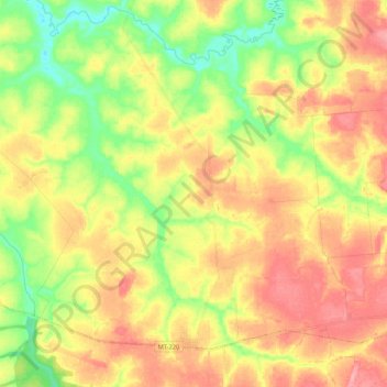
Name: Córrego Barracão topographic map, elevation, terrain.
Average elevation: 1,138 ft
Minimum elevation: 984 ft
Maximum elevation: 1,283 ft
Other topographic maps
Click on a map to view its topography, its elevation and its terrain.
Rio dos Peixes
Brasil > Mato Grosso > Tabaporã
Rio dos Peixes, Tabaporã, Microrregião de Arinos, Mesorregião Norte Mato-Grossense, Mato Grosso, Região Centro-Oeste, Brasil
Average elevation: 1,037 ft