
Fagernes topographic map
Interactive map
Click on the map to display elevation.
About this map
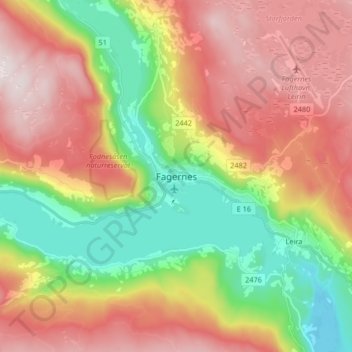
Name: Fagernes topographic map, elevation, terrain.
Location: Fagernes, Nord-Aurdal, Innlandet, 2900, Norway (60.94610 9.19641 61.02610 9.27641)
Average elevation: 1,988 ft
Minimum elevation: 1,043 ft
Maximum elevation: 2,995 ft