
Ballston topographic map
Interactive map
Click on the map to display elevation.
About this map
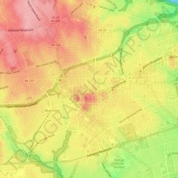
Name: Ballston topographic map, elevation, terrain.
Location: Ballston, Arlington County, Virginia, 22230, USA (38.86312 -77.13009 38.90312 -77.09009)
Average elevation: 272 ft
Minimum elevation: -3 ft
Maximum elevation: 433 ft