
Fuller Field topographic map
Interactive map
Click on the map to display elevation.
About this map
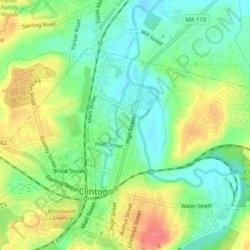
Name: Fuller Field topographic map, elevation, terrain.
Location: Fuller Field, Clinton, Worcester, Massachusetts, USA (42.42726 -71.68345 42.42949 -71.68196)
Average elevation: 312 ft
Minimum elevation: 223 ft
Maximum elevation: 433 ft
Other topographic maps
Click on a map to view its topography, its elevation and its terrain.
Mossy Pond
USA > Massachusetts > Clinton
Mossy Pond, Pine Street, Clinton, Worcester, Massachusetts, 01510, USA
Average elevation: 364 ft