
Huccorgne topographic map
Interactive map
Click on the map to display elevation.
About this map
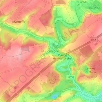
Name: Huccorgne topographic map, elevation, terrain.
Location: Huccorgne, Wanze, Luik, Wallonië, 4520, België (50.54759 5.14476 50.58759 5.18476)
Average elevation: 469 ft
Minimum elevation: 213 ft
Maximum elevation: 630 ft