
Sainte-Agathe-Nord topographic map
Interactive map
Click on the map to display elevation.
About this map
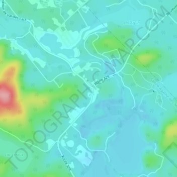
Name: Sainte-Agathe-Nord topographic map, elevation, terrain.
Average elevation: 1,270 ft
Minimum elevation: 1,191 ft
Maximum elevation: 1,624 ft
Other topographic maps
Click on a map to view its topography, its elevation and its terrain.
Sainte-Agathe-des-Monts
Canada > Quebec > Sainte-Agathe-des-Monts
Sainte-Agathe-des-Monts, Les Laurentides, Laurentides, Quebec, Canada
Average elevation: 1,371 ft