
Casablanca topographic map
Interactive map
Click on the map to display elevation.
About this map
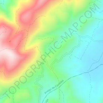
Name: Casablanca topographic map, elevation, terrain.
Location: Casablanca, Priego de Córdoba, Cordova, Vandalitia, Spagna (37.37949 -4.13583 37.39949 -4.11583)
Average elevation: 3,264 ft
Minimum elevation: 2,700 ft
Maximum elevation: 4,213 ft