
Borrowdale topographic map
Interactive map
Click on the map to display elevation.
About this map
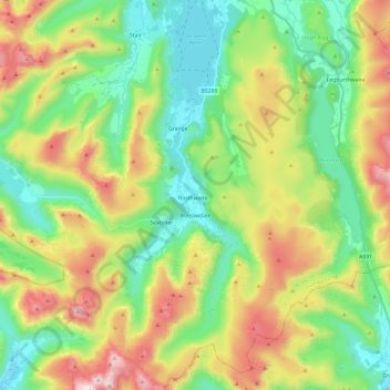
Name: Borrowdale topographic map, elevation, terrain.
Location: Borrowdale, Allerdale, Cumbria, England, United Kingdom (54.45410 -3.21932 54.59275 -3.08723)
Average elevation: 1,260 ft
Minimum elevation: 203 ft
Maximum elevation: 3,179 ft