
Pereiro topographic map
Interactive map
Click on the map to display elevation.
About this map
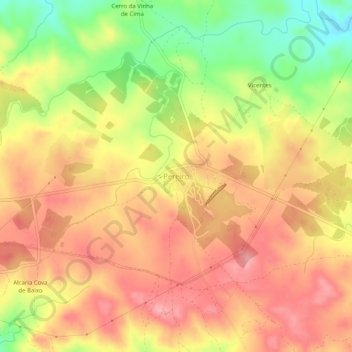
Name: Pereiro topographic map, elevation, terrain.
Location: Pereiro, Alcoutim e Pereiro, Alcoutim, Faro, Portugal (37.42604 -7.61681 37.46604 -7.57681)
Average elevation: 764 ft
Minimum elevation: 545 ft
Maximum elevation: 902 ft
Other topographic maps
Click on a map to view its topography, its elevation and its terrain.
Alcoutim
Portugal > Faro > Alcoutim e Pereiro > Alcoutim
Alcoutim, Alcoutim e Pereiro, Alcoutim, Faro, Portugal
Average elevation: 194 ft