
San Salvador de Padreiro topographic map
Interactive map
Click on the map to display elevation.
About this map
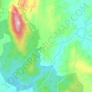
Name: San Salvador de Padreiro topographic map, elevation, terrain.
Average elevation: 1,243 ft
Minimum elevation: 1,043 ft
Maximum elevation: 1,752 ft
Other topographic maps
Click on a map to view its topography, its elevation and its terrain.
Santa Comba
Santa Comba, O Xallas, A Corogne, Galice, 15840, Espagne
Average elevation: 1,184 ft