
Llwynmawr topographic map
Interactive map
Click on the map to display elevation.
About this map
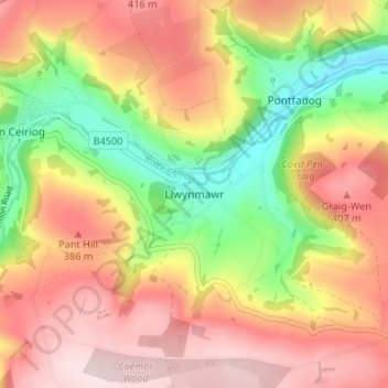
Name: Llwynmawr topographic map, elevation, terrain.
Location: Llwynmawr, Wrexham, Wales, LL20 7BA, United Kingdom (52.90511 -3.17791 52.94511 -3.13791)
Average elevation: 978 ft
Minimum elevation: 390 ft
Maximum elevation: 1,463 ft
Other topographic maps
Click on a map to view its topography, its elevation and its terrain.
Wrexham
United Kingdom > Wales > Wrexham
Wrexham, Wales, LL11 1AP, United Kingdom
Average elevation: 456 ft