
Conseil régional de la vallée de Jezreel topographic map
Interactive map
Click on the map to display elevation.
About this map
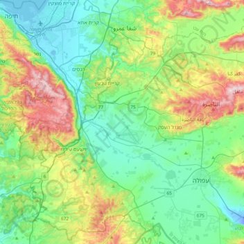
Name: Conseil régional de la vallée de Jezreel topographic map, elevation, terrain.
Average elevation: 518 ft
Minimum elevation: -72 ft
Maximum elevation: 1,847 ft
Other topographic maps
Click on a map to view its topography, its elevation and its terrain.
Ein Dor
Israël > District nord > Conseil régional de la vallée de Jezreel
Ein Dor, Conseil régional de la vallée de Jezreel, נפת יזרעאל, District nord, Israël
Average elevation: 318 ft