Pinola topographic map
Interactive map
Click on the map to display elevation.
About this map
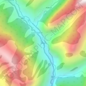
Name: Pinola topographic map, elevation, terrain.
Average elevation: 8,051 ft
Minimum elevation: 5,322 ft
Maximum elevation: 11,673 ft

Click on the map to display elevation.
Name: Pinola topographic map, elevation, terrain.
Average elevation: 8,051 ft
Minimum elevation: 5,322 ft
Maximum elevation: 11,673 ft