
Jelenia Góra topographic map
Interactive map
Click on the map to display elevation.
About this map
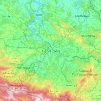
Name: Jelenia Góra topographic map, elevation, terrain.
Location: Jelenia Góra, Lower Silesian Voivodeship, 58-500, Poland (50.74310 15.57443 51.06310 15.89443)
Average elevation: 1,690 ft
Minimum elevation: 719 ft
Maximum elevation: 4,911 ft