
Platón Sánchez topographic map
Interactive map
Click on the map to display elevation.
About this map
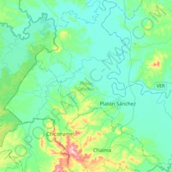
Name: Platón Sánchez topographic map, elevation, terrain.
Location: Platón Sánchez, Veracruz, Mexico (21.17740 -98.49784 21.41622 -98.24870)
Average elevation: 344 ft
Minimum elevation: 89 ft
Maximum elevation: 1,526 ft