
Samara topographic map
Interactive map
Click on the map to display elevation.
About this map
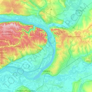
Name: Samara topographic map, elevation, terrain.
Location: Samara, Samara Oblast, Volga Federal District, 443028, Russia (53.09190 49.73139 53.55093 50.39039)
Average elevation: 325 ft
Minimum elevation: 79 ft
Maximum elevation: 1,227 ft