
Thank you for supporting this site ❤️
Make a donation
Make a donation
Gear up for your next adventure:
As an Amazon Associate, this site earns from qualifying purchases at no extra cost to you.
Ulrichstein topographic map
Click on the map to display elevation.
Thank you for supporting this site ❤️
Make a donation
Make a donation
Gear up for your next adventure:
As an Amazon Associate, this site earns from qualifying purchases at no extra cost to you.
About this map
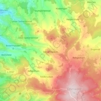
Name: Ulrichstein topographic map, elevation, terrain.
Location: Ulrichstein, Vogelsbergkreis, Hesse, 35327, Germany (50.53367 9.10466 50.62084 9.26062)
Average elevation: 1,713 ft
Minimum elevation: 1,030 ft
Maximum elevation: 2,477 ft
Thank you for supporting this site ❤️
Make a donation
Make a donation
Gear up for your next adventure:
As an Amazon Associate, this site earns from qualifying purchases at no extra cost to you.