
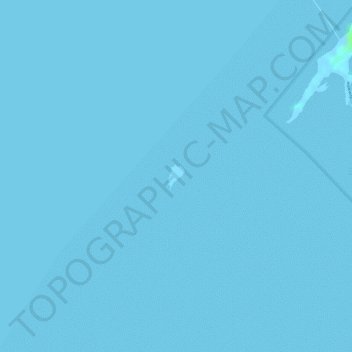
Sulpa Islet topographic map
Interactive map
Click on the map to display elevation.
About this map
Name: Sulpa Islet topographic map, elevation, terrain.
Location: Sulpa Islet, Lapu-Lapu, Cebu, Central Visayas, Philippines (10.23663 124.01071 10.23820 124.01180)
Average elevation: 0 ft
Minimum elevation: -7 ft
Maximum elevation: 23 ft
Other topographic maps
Click on a map to view its topography, its elevation and its terrain.
Olango Island
Philippines > Cebu > Lapu-Lapu
Olango Island, Lapu-Lapu, Cebu, Central Visayas, Philippines
Average elevation: 7 ft
Mactan
Philippines > Cebu > Lapu-Lapu
Mactan, Lapu-Lapu, Cebu, Central Visayas, Philippines
Average elevation: 10 ft
Hilutungan Sanctuary
Philippines > Cebu > Lapu-Lapu
Hilutungan Sanctuary, Simean Amodia, Pacific Grand Villas, Lapu-Lapu, Cebu, Central Visayas, 6017, Philippines
Average elevation: 0 ft
Gilutongan Island
Philippines > Cebu > Lapu-Lapu
Gilutongan Island, Lapu-Lapu, Cebu, Central Visayas, Philippines
Average elevation: 0 ft