
Geldermalsen topographic map
Interactive map
Click on the map to display elevation.
About this map
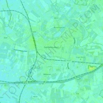
Name: Geldermalsen topographic map, elevation, terrain.
Location: Geldermalsen, West Betuwe, Gelderland, Nederland (51.85805 5.24013 51.89663 5.33955)
Average elevation: 13 ft
Minimum elevation: 0 ft
Maximum elevation: 36 ft
Other topographic maps
Click on a map to view its topography, its elevation and its terrain.
Beesd
Nederland > Gelderland > West Betuwe
Beesd, West Betuwe, Gelderland, Nederland
Average elevation: 7 ft
Acquoy
Nederland > Gelderland > West Betuwe
Acquoy, West Betuwe, Gelderland, Nederland
Average elevation: 7 ft
Hellouw
Nederland > Gelderland > West Betuwe > Hellouw
Hellouw, West Betuwe, Gelderland, Nederland, 4174, Nederland
Average elevation: 10 ft
Heesselt
Nederland > Gelderland > West Betuwe
Heesselt, West Betuwe, Gelderland, Nederland
Average elevation: 16 ft