
Mugardos topographic map
Interactive map
Click on the map to display elevation.
About this map
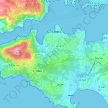
Name: Mugardos topographic map, elevation, terrain.
Location: Mugardos, Ferrol, La Coruña, Galicia, España (43.43273 -8.27905 43.46621 -8.19623)
Average elevation: 131 ft
Minimum elevation: -3 ft
Maximum elevation: 850 ft