
Alt Tucheband topographic map
Interactive map
Click on the map to display elevation.
About this map
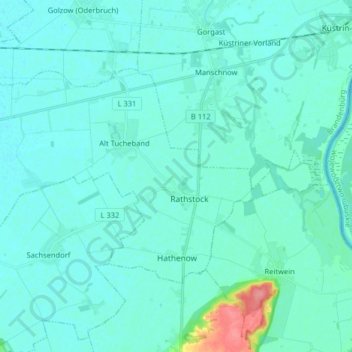
Name: Alt Tucheband topographic map, elevation, terrain.
Location: Alt Tucheband, Golzow, Märkisch-Oderland, Brandenburg, Germany (52.49810 14.44164 52.55792 14.60232)
Average elevation: 46 ft
Minimum elevation: 20 ft
Maximum elevation: 269 ft