
Berdeogas topographic map
Interactive map
Click on the map to display elevation.
About this map
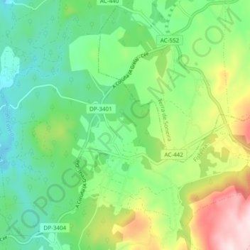
Name: Berdeogas topographic map, elevation, terrain.
Location: Berdeogas, Dumbría, Finisterre, La Coruña, Galicia, España (43.01617 -9.13680 43.06312 -9.06195)
Average elevation: 791 ft
Minimum elevation: 361 ft
Maximum elevation: 1,673 ft