
Rostock topographic map
Interactive map
Click on the map to display elevation.
About this map
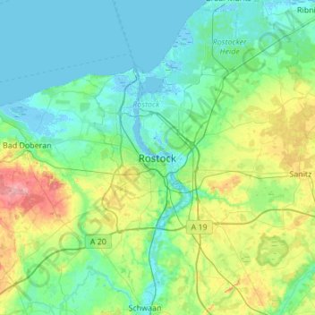
Name: Rostock topographic map, elevation, terrain.
Location: Rostock, Mecklembourg-Poméranie-Occidentale, 18057, Allemagne (53.93244 11.96861 54.25244 12.28861)
Average elevation: 75 ft
Minimum elevation: -16 ft
Maximum elevation: 367 ft
Other topographic maps
Click on a map to view its topography, its elevation and its terrain.
Rostock
Allemagne > Mecklembourg-Poméranie-Occidentale > Rostock
Rostock, Mecklembourg-Poméranie-Occidentale, Allemagne
Average elevation: 46 ft