
鞍山市 topographic map
Interactive map
Click on the map to display elevation.
About this map
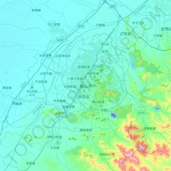
Name: 鞍山市 topographic map, elevation, terrain.
Location: 鞍山市, 铁东区, 鞍山市, 辽宁省, 中国 (40.94812 122.82997 41.26812 123.14997)
Average elevation: 256 ft
Minimum elevation: -197 ft
Maximum elevation: 2,198 ft
Other topographic maps
Click on a map to view its topography, its elevation and its terrain.