
Pozos topographic map
Interactive map
Click on the map to display elevation.
About this map
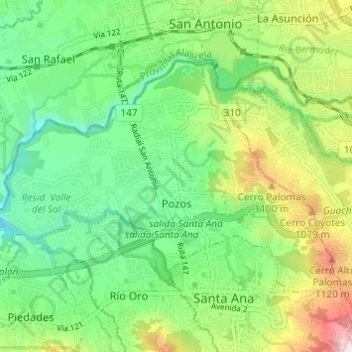
Name: Pozos topographic map, elevation, terrain.
Location: Pozos, Cantón Santa Ana, Provincia San José, 10903, Costa Rica (9.93365 -84.22273 9.97352 -84.16244)
Average elevation: 2,966 ft
Minimum elevation: 2,418 ft
Maximum elevation: 3,996 ft