

Niihau topographic map
Click on the map to display elevation.
Niihau
Niʻihau is located about 18 miles (29 km) west of Kauaʻi, and the tiny, uninhabited island of Lehua lies 0.7 miles (0.61 nmi; 1.1 km) north of Niʻihau. Niʻihau's dimensions are 6.2 miles by 18.6 miles (10 km × 30 km). The maximum elevation (Paniau) is 1,280 feet (390 m). The island is about 6 million years old, making it geologically older than the 5.8-million-year-old neighboring island of Kauaʻi to the northeast. Niʻihau is the remnant of the southwestern slope of what was once a much larger volcano. The entire summit and other slopes collapsed into the ocean in a giant prehistoric landslide.
About this map
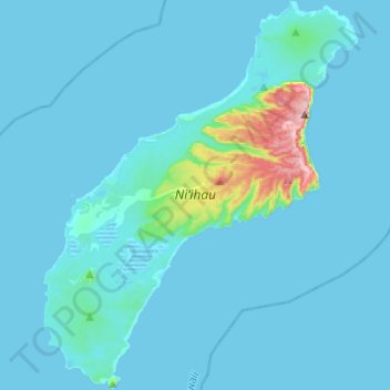
Name: Niihau topographic map, elevation, terrain.
Location: Niihau, Puuwai, Kauaʻi County, Hawaii, United States (21.77906 -160.24700 22.00540 -160.04962)
Average elevation: 75 ft
Minimum elevation: -7 ft
Maximum elevation: 1,266 ft
Kauaʻi County trails, hiking, mountain biking, running and outdoor activities