
Otopeni topographic map
Interactive map
Click on the map to display elevation.
About this map
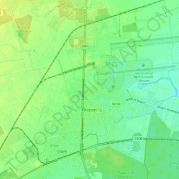
Name: Otopeni topographic map, elevation, terrain.
Location: Otopeni, Ilfov, Romania (44.52355 26.02682 44.59401 26.12324)
Average elevation: 315 ft
Minimum elevation: 285 ft
Maximum elevation: 344 ft
Other topographic maps
Click on a map to view its topography, its elevation and its terrain.
Ștefăneștii de Jos
Ștefăneștii de Jos, Ilfov, 077175, Romania
Average elevation: 282 ft