Geolocate

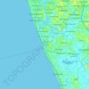
Walana topographic map

Click on the map to display elevation.

About this map

Name: Walana topographic map, elevation, terrain.

Location: Walana, Panadura DS Division, Kalutara District, Western Province, 12500, Sri Lanka (6.71118 79.88475 6.75118 79.92475)

Average elevation: 20 ft

Minimum elevation: 0 ft

Maximum elevation: 95 ft

Other topographic maps

Click on a map to view its topography, its elevation and its terrain.
Gear up for your next adventure:

🪶Trail Camera - Capture wildlife on your hikes
🌡️Portable Weather Meter - Track weather conditions on the trail
🔭Telescopic Hiking Pole - Adjustable pole for hiking stability
🥾Women's Hiking Boots - Top-rated trail boots with ankle support and superior grip
🎒Trekking Poles - Sturdy poles for balance and stability on rough terrain

As an Amazon Associate, this site earns from qualifying purchases at no extra cost to you.