Geolocate

Solomon topographic map

Click on the map to display elevation.

About this map
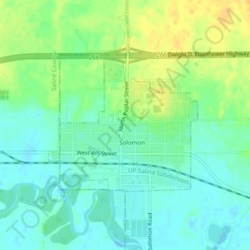
Name: Solomon topographic map, elevation, terrain.

Location: Solomon, Dickinson County, Kansas, United States (38.91413 -97.38277 38.92853 -97.36200)

Average elevation: 1,194 ft

Minimum elevation: 1,158 ft

Maximum elevation: 1,247 ft

Dickinson County trails, hiking, mountain biking, running and outdoor activities

Other topographic maps

Click on a map to view its topography, its elevation and its terrain.
Industry

United States > Kansas > Dickinson County

Average elevation: 1,214 ft

Gear up for your next adventure:

🚪Portable Camp Chair - Foldable chair for comfort at camp
🧼Biodegradable Camping Soap - Eco‑friendly soap for outdoor hygiene
👓Polarized Sunglasses - Outdoor sunglasses for glare reduction
🧭Map Reading Tools - Tools and kits for map navigation
🧭Pro Hiking Compasses - High-accuracy liquid-filled compasses for topographic orientation

As an Amazon Associate, this site earns from qualifying purchases at no extra cost to you.