
Laguna Venecia topographic map
Interactive map
Click on the map to display elevation.
About this map
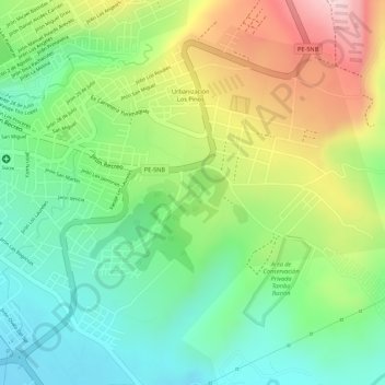
Name: Laguna Venecia topographic map, elevation, terrain.
Average elevation: 1,266 ft
Minimum elevation: 892 ft
Maximum elevation: 1,804 ft
Other topographic maps
Click on a map to view its topography, its elevation and its terrain.
RIO CHOCLINO
Perú > San Martín > La Banda de Shilcayo
RIO CHOCLINO, Tarapoto, La Banda, La Banda de Shilcayo, Provincia de San Martín, San Martín, 22202, Perú
Average elevation: 1,086 ft