
West Granby topographic map
Interactive map
Click on the map to display elevation.
About this map
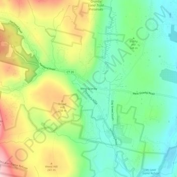
Name: West Granby topographic map, elevation, terrain.
Average elevation: 525 ft
Minimum elevation: 203 ft
Maximum elevation: 1,037 ft
Other topographic maps
Click on a map to view its topography, its elevation and its terrain.
North Granby
United States > Connecticut > Capitol Planning Region > Granby
North Granby, Granby, Capitol Planning Region, Connecticut, 06060, United States
Average elevation: 545 ft