
Pachiza topographic map
Interactive map
Click on the map to display elevation.
About this map
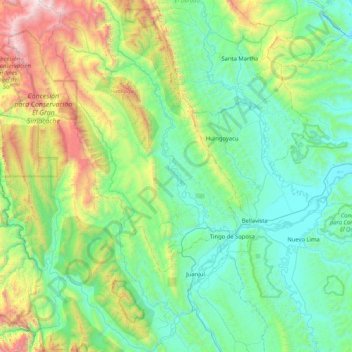
Name: Pachiza topographic map, elevation, terrain.
Location: Pachiza, Mariscal Cáceres, San Martín, Peru (-7.36288 -77.24735 -6.53799 -76.73023)
Average elevation: 2,352 ft
Minimum elevation: 669 ft
Maximum elevation: 8,701 ft