
Río Guadámez topographic map
Interactive map
Click on the map to display elevation.
About this map
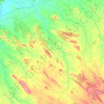
Name: Río Guadámez topographic map, elevation, terrain.
Location: Río Guadámez, Don Benito, Badajoz, Extremadura, España (38.47921 -6.13805 38.94964 -5.79723)
Average elevation: 1,371 ft
Minimum elevation: 705 ft
Maximum elevation: 2,992 ft
Other topographic maps
Click on a map to view its topography, its elevation and its terrain.
Zaldivar
España > Extremadura > Don Benito
Zaldivar, Don Benito, Badajoz, Extremadura, España
Average elevation: 879 ft
Fregenal
España > Extremadura > Don Benito
Fregenal, Don Benito, Badajoz, Extremadura, 06400, España
Average elevation: 823 ft
Río Gargáligas
España > Extremadura > Don Benito
Río Gargáligas, Don Benito, Badajoz, Extremadura, España
Average elevation: 853 ft
San Isidro
España > Extremadura > Don Benito
San Isidro, Don Benito, Badajoz, Extremadura, 06400, España
Average elevation: 846 ft