
Thank you for supporting this site ❤️
Make a donation
Make a donation
Gear up for your next adventure:
As an Amazon Associate, this site earns from qualifying purchases at no extra cost to you.
Pavas topographic map
Click on the map to display elevation.
Thank you for supporting this site ❤️
Make a donation
Make a donation
Gear up for your next adventure:
As an Amazon Associate, this site earns from qualifying purchases at no extra cost to you.
About this map
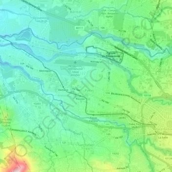
Name: Pavas topographic map, elevation, terrain.
Location: Pavas, San José, San Jose Province, 10109, Costa Rica (9.93532 -84.16831 9.96384 -84.11001)
Average elevation: 3,409 ft
Minimum elevation: 3,041 ft
Maximum elevation: 4,370 ft
Thank you for supporting this site ❤️
Make a donation
Make a donation
Gear up for your next adventure:
As an Amazon Associate, this site earns from qualifying purchases at no extra cost to you.