Geolocate

Paradise topographic map

Click on the map to display elevation.

About this map

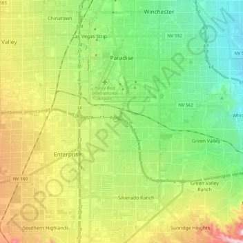
Name: Paradise topographic map, elevation, terrain.

Location: Paradise, Clark County, Nevada, United States (36.01323 -115.20816 36.13171 -115.06393)

Average elevation: 2,126 ft

Minimum elevation: 1,745 ft

Maximum elevation: 2,448 ft

Clark County trails, hiking, mountain biking, running and outdoor activities

Gear up for your next adventure:

🔥Plasma Lighters - Windproof lighters that work in any weather condition
🔦Compact Flashlight - Reliable flashlight for emergencies
🧭Compass with Lanyard - Easy‑carry compass for navigation
🛌Ultralight Sleeping Bags - Compact down bags for cold nights in the wilderness
🖼️Topo Map Wall Art - Decorative topographic prints of famous peaks and regions

As an Amazon Associate, this site earns from qualifying purchases at no extra cost to you.