Geolocate

Beilen topographic map

Click on the map to display elevation.

About this map

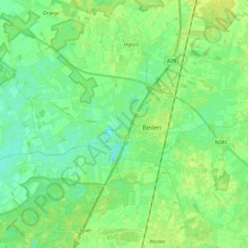
Name: Beilen topographic map, elevation, terrain.

Location: Beilen, Midden-Drenthe, Drenthe, Netherlands (52.82136 6.41329 52.90355 6.58058)

Average elevation: 46 ft

Minimum elevation: 23 ft

Maximum elevation: 69 ft

Gear up for your next adventure:

📷Action Camera - Capture your outdoor adventures in HD
🪶Camp Gear Gift Set - Perfect gift bundle for outdoor fans
🛠️Outdoor Gear Repair Kit - Essential tools to fix gear on the trail
🔥Fast-Boil Camping Stoves - Efficient cooking systems for quick trail meals
📡GPS Antenna Upgrade - Enhance GPS reception in remote terrain

As an Amazon Associate, this site earns from qualifying purchases at no extra cost to you.