
Cagliara topographic map
Interactive map
Click on the map to display elevation.
About this map
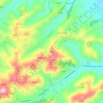
Name: Cagliara topographic map, elevation, terrain.
Location: Cagliara, Traversetolo, Parma, Émilie-Romagne, 43029, Italie (44.60582 10.32185 44.64582 10.36185)
Average elevation: 942 ft
Minimum elevation: 571 ft
Maximum elevation: 1,480 ft