
Bonconseil topographic map
Interactive map
Click on the map to display elevation.
About this map
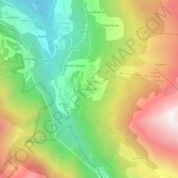
Name: Bonconseil topographic map, elevation, terrain.
Average elevation: 5,472 ft
Minimum elevation: 2,966 ft
Maximum elevation: 8,629 ft
Other topographic maps
Click on a map to view its topography, its elevation and its terrain.
Montalbert
Frankrijk > Auvergne-Rhône-Alpes > Savoie > Sainte-Foy-Tarentaise
Montalbert, Sainte-Foy-Tarentaise, Albertville, Savoie, Auvergne-Rhône-Alpes, Metropolitaans Frankrijk, 73640, Frankrijk
Average elevation: 5,253 ft