
Bab’N’Ali topographic map
Interactive map
Click on the map to display elevation.
About this map
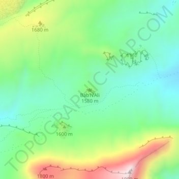
Name: Bab’N’Ali topographic map, elevation, terrain.
Average elevation: 5,161 ft
Minimum elevation: 4,610 ft
Maximum elevation: 6,257 ft
Other topographic maps
Click on a map to view its topography, its elevation and its terrain.
N'Kob
Maroc > cercle d'Agdz > N'Kob
N'Kob, caïdat de N'Kob, cercle d'Agdz, Province de Zagora, Drâa-Tafilalet, 47702, Maroc
Average elevation: 4,859 ft