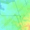
Florida topographic map
Click on the map to display elevation.
Florida
The municipality is located northwest of its province, next to the borders with Ciego de Ávila Province. Its elevation is represented by the Urabo Mountain with a height of 132.5 m. The bordering municipalities are Baraguá, Céspedes, Esmeralda, Camagüey and Vertientes.
About this map

Name: Florida topographic map, elevation, terrain.
Location: Florida, Camagüey, Cuba (21.27483 -78.65029 21.71573 -77.96510)
Average elevation: 180 ft
Minimum elevation: -10 ft
Maximum elevation: 866 ft
Other topographic maps
Click on a map to view its topography, its elevation and its terrain.