
Ennal topographic map
Interactive map
Click on the map to display elevation.
About this map
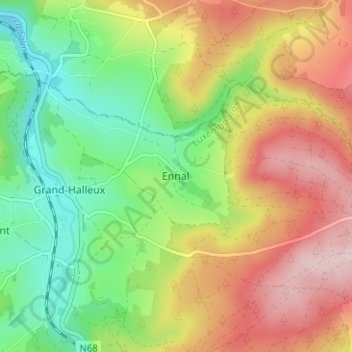
Name: Ennal topographic map, elevation, terrain.
Location: Ennal, Vielsalm, Bastenaken, Luxemburg, Wallonië, 6698, België (50.30780 5.90622 50.34780 5.94622)
Average elevation: 1,371 ft
Minimum elevation: 942 ft
Maximum elevation: 1,896 ft