
Szalafő topographic map
Interactive map
Click on the map to display elevation.
About this map
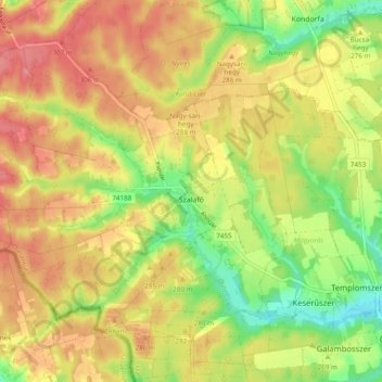
Name: Szalafő topographic map, elevation, terrain.
Average elevation: 899 ft
Minimum elevation: 735 ft
Maximum elevation: 1,037 ft
Other topographic maps
Click on a map to view its topography, its elevation and its terrain.
Szombathely
Szombathely, Szombathelyi járás, Vas, Western Transdanubia, Transdanubia, Hungary
Average elevation: 722 ft
Szentléránt
Hungary > Vas > Sorkifalud
Szentléránt, Sorkifalud, Szombathelyi járás, Vas, Western Transdanubia, Transdanubia, 9774, Hungary
Average elevation: 610 ft
Sorkifalud
Sorkifalud, Szombathelyi járás, Vas, Western Transdanubia, Transdanubia, 9774, Hungary
Average elevation: 607 ft
Celldömölk
Celldömölk, Celldömölki járás, Vas, Western Transdanubia, Transdanubia, Hungary
Average elevation: 436 ft