
Thank you for supporting this site ❤️
Make a donation
Make a donation
Gear up for your next adventure:
As an Amazon Associate, this site earns from qualifying purchases at no extra cost to you.
Racalmuto topographic map
Click on the map to display elevation.
Thank you for supporting this site ❤️
Make a donation
Make a donation
Gear up for your next adventure:
As an Amazon Associate, this site earns from qualifying purchases at no extra cost to you.
About this map
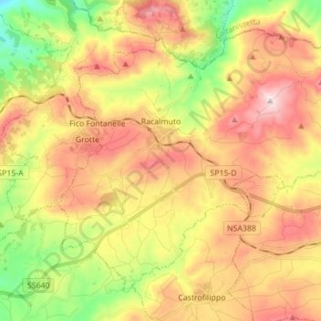
Name: Racalmuto topographic map, elevation, terrain.
Location: Racalmuto, Agrigento, Sicily, 92020, Italy (37.35027 13.68798 37.44064 13.82643)
Average elevation: 1,457 ft
Minimum elevation: 545 ft
Maximum elevation: 2,362 ft
Thank you for supporting this site ❤️
Make a donation
Make a donation
Gear up for your next adventure:
As an Amazon Associate, this site earns from qualifying purchases at no extra cost to you.