Geolocate

Darvel topographic map

Click on the map to display elevation.

About this map

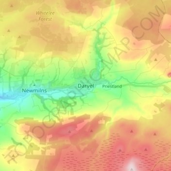
Name: Darvel topographic map, elevation, terrain.

Location: Darvel, East Ayrshire, Scotland, KA17 0AA, United Kingdom (55.56972 -4.32184 55.64972 -4.24184)

Average elevation: 702 ft

Minimum elevation: 177 ft

Maximum elevation: 1,263 ft

Gear up for your next adventure:

🚗GPS Dash Cams - Record your scenic drives through mountain passes and canyons
🩹Survival Bandages - High‑quality bandages for emergencies
🕶️Glacier Sunglasses - Side shields to protect eyes from high-altitude snow glare
🧭Map Reading Tools - Tools and kits for map navigation
🪶Survival Guide Book - Expert advice for emergency preparedness

As an Amazon Associate, this site earns from qualifying purchases at no extra cost to you.