Geolocate

Alae topographic map

Click on the map to display elevation.

About this map

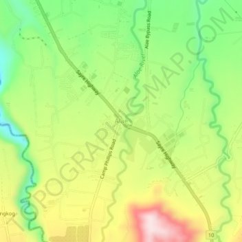
Name: Alae topographic map, elevation, terrain.

Location: Alae, Manolo Fortich, Bukidnon, Northern Mindanao, Philippines (8.40263 124.79425 8.44263 124.83425)

Average elevation: 1,355 ft

Minimum elevation: 804 ft

Maximum elevation: 2,034 ft

Gear up for your next adventure:

📷Action Cameras - Rugged cameras to document your journeys across rugged terrain
🌎3D Topographic Globes - Raised relief globes for a tactile understanding of geography
Backpacking Tents - Weight-optimized shelters for multi-day topographic surveys
🧦Hiking Socks - Comfortable socks to prevent blisters on long hikes
📦Dry Bags Set - Waterproof storage for electronics and clothes

As an Amazon Associate, this site earns from qualifying purchases at no extra cost to you.