
Cape Kidnappers / Te Kauwae-a-Māui topographic map
Interactive map
Click on the map to display elevation.
About this map
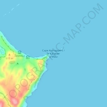
Name: Cape Kidnappers / Te Kauwae-a-Māui topographic map, elevation, terrain.
Average elevation: 52 ft
Minimum elevation: 0 ft
Maximum elevation: 541 ft
Other topographic maps
Click on a map to view its topography, its elevation and its terrain.
Hastings
New Zealand > Hawke's Bay > Hastings District
Hastings, Hastings District, Hawke's Bay, 4122, New Zealand
Average elevation: 223 ft