
La Estación topographic map
Interactive map
Click on the map to display elevation.
About this map
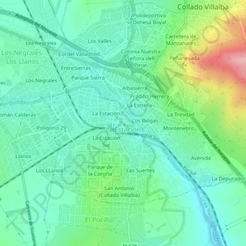
Name: La Estación topographic map, elevation, terrain.
Location: La Estación, Collado Villalba, Communauté de Madrid, Espagne (40.61619 -4.02935 40.63835 -3.98524)
Average elevation: 2,923 ft
Minimum elevation: 2,789 ft
Maximum elevation: 3,287 ft