
Penukonda topographic map
Interactive map
Click on the map to display elevation.
About this map
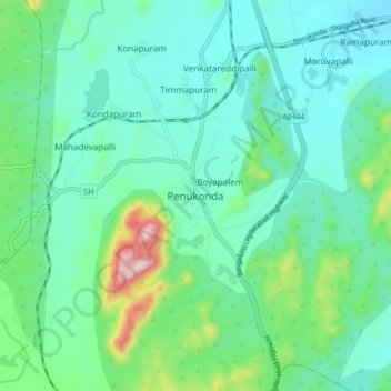
Name: Penukonda topographic map, elevation, terrain.
Location: Penukonda, Anantapur, Andhra Pradesh, 515110, India (14.04468 77.55665 14.12468 77.63665)
Average elevation: 1,942 ft
Minimum elevation: 1,637 ft
Maximum elevation: 3,094 ft