
Enrouzat topographic map
Interactive map
Click on the map to display elevation.
About this map
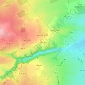
Name: Enrouzat topographic map, elevation, terrain.
Average elevation: 981 ft
Minimum elevation: 728 ft
Maximum elevation: 1,247 ft
Other topographic maps
Click on a map to view its topography, its elevation and its terrain.
Souvol
France > Auvergne-Rhône-Alpes > Allier > La Chapelaude
Souvol, La Chapelaude, Montluçon, Allier, Auvergne-Rhône-Alpes, France métropolitaine, 03380, France
Average elevation: 879 ft
Les Bregettes
France > Auvergne-Rhône-Alpes > Allier > La Chapelaude
Les Bregettes, La Chapelaude, Montluçon, Allier, Auvergne-Rhône-Alpes, France métropolitaine, 03380, France
Average elevation: 938 ft