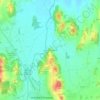
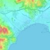
Mont-ras topographic map
Click on the map to display elevation.
About this map

Name: Mont-ras topographic map, elevation, terrain.
Location: Mont-ras, Lower Empordà, Girona, Catalonia, 17253, Spain (41.86704 3.12357 41.91854 3.17951)
Average elevation: 256 ft
Minimum elevation: 0 ft
Maximum elevation: 945 ft
Other topographic maps
Click on a map to view its topography, its elevation and its terrain.

Platja d'Aro
Spain > Catalonia > Lower Empordà > Castell d'Aro, Platja d'Aro i s'Agaró
Average elevation: 154 ft
Sant Antoni de Calonge
Spain > Catalonia > Lower Empordà > Calonge i Sant Antoni
Average elevation: 66 ft